


MONROE, Allen County, Indiana
About
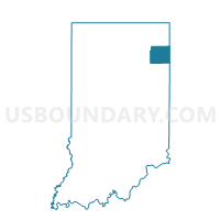
Outline

Summary
| Unique Area Identifier | 576153 |
| Name | MONROE |
| County | Allen County |
| State | Indiana |
| Area (square miles) | 24.00 |
| Land Area (square miles) | 24.00 |
| Water Area (square miles) | 0.00 |
| % of Land Area | 100.00 |
| % of Water Area | 0.00 |
| Latitude of the Internal Point | 40.96498160 |
| Longtitude of the Internal Point | -84.84177510 |
Maps


Graphs
Select a template below for downloading or customizing gragh for MONROE, Allen County, Indiana


Neighbors
Neighoring Voting District (by Name) Neighboring Voting District on the Map
- Voting District BENTON TWP, Paulding County, OH
- EAST ROOT, Adams County, IN
- JACKSON, Allen County, IN
- JEFFERSON, Allen County, IN
- MADISON, Allen County, IN
- MONROEVILLE, Allen County, IN
- PRECINCT TULLY, Van Wert County, OH
- UNION, Adams County, IN
Top 10 Neighboring County Subdivision (by Population) Neighboring County Subdivision on the Map
- Root township, Adams County, IN (4,443)
- Jefferson township, Allen County, IN (2,109)
- Tully township, Van Wert County, OH (2,054)
- Monroe township, Allen County, IN (1,927)
- Madison township, Allen County, IN (1,771)
- Benton township, Paulding County, OH (1,046)
- Union township, Adams County, IN (922)
- Jackson township, Allen County, IN (504)
Top 10 Neighboring Place (by Population) Neighboring Place on the Map
Top 10 Neighboring Unified School District (by Population) Neighboring Unified School District on the Map
- East Allen County Schools, IN (65,612)
- North Adams Community Schools, IN (15,072)
- Wayne Trace Local School District, OH (5,645)
- Crestview Local School District, OH (4,633)
Top 10 Neighboring State Legislative District Lower Chamber (by Population) Neighboring State Legislative District Lower Chamber on the Map
Top 10 Neighboring State Legislative District Upper Chamber (by Population) Neighboring State Legislative District Upper Chamber on the Map
- State Senate District 1, OH (351,303)
- State Senate District 14, IN (139,068)
- State Senate District 19, IN (118,949)
Top 10 Neighboring 111th Congressional District (by Population) Neighboring 111th Congressional District on the Map
- Congressional District 3, IN (723,633)
- Congressional District 6, IN (676,548)
- Congressional District 5, OH (627,799)
Top 10 Neighboring Census Tract (by Population) Neighboring Census Tract on the Map
- Census Tract 301, Adams County, IN (4,737)
- Census Tract 202, Van Wert County, OH (4,516)
- Census Tract 9603, Paulding County, OH (4,219)
- Census Tract 110, Allen County, IN (2,613)
- Census Tract 119, Allen County, IN (1,927)
- Census Tract 118.02, Allen County, IN (1,771)